
King Tide December 22-23, 2018 & January 20-21, 2019
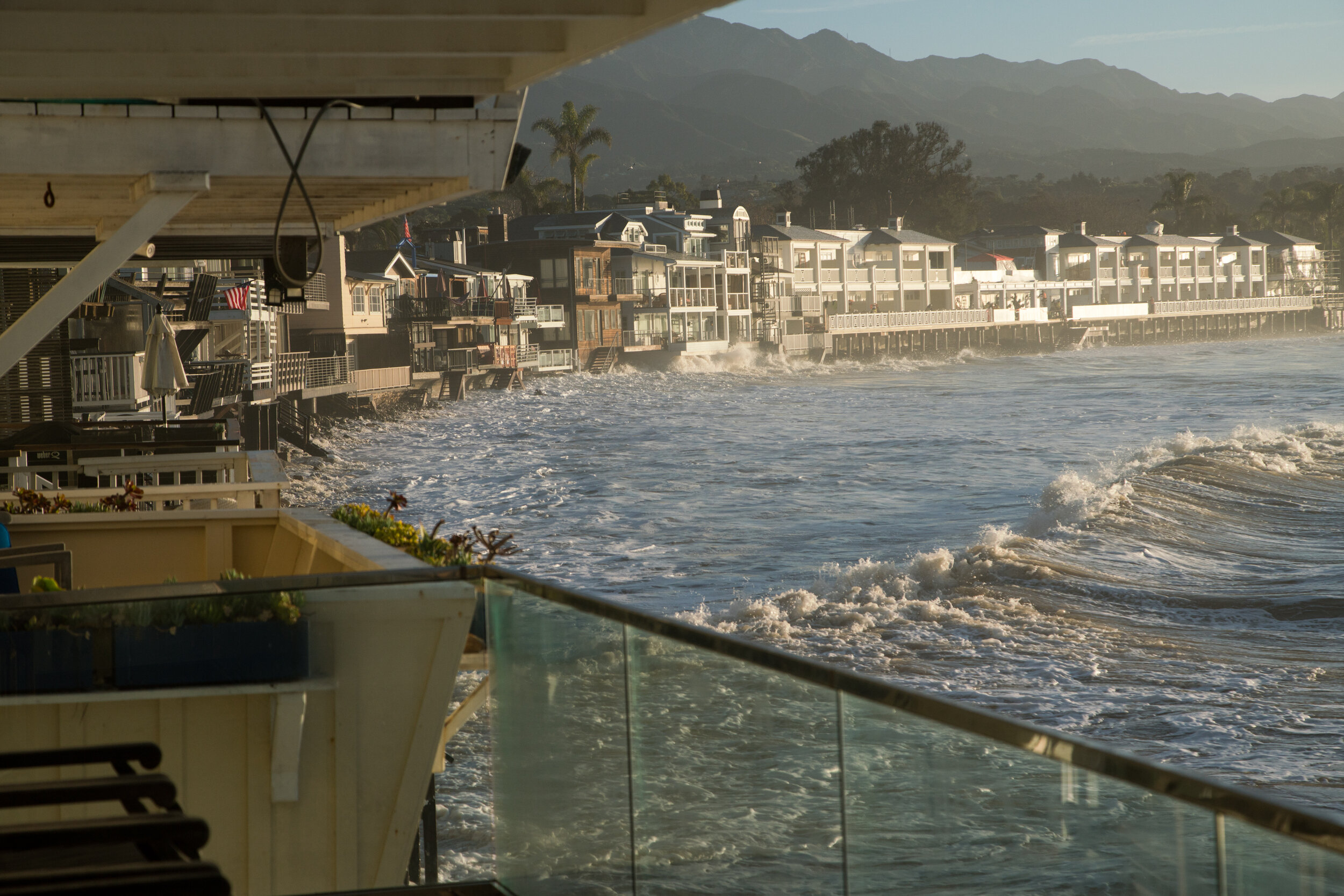
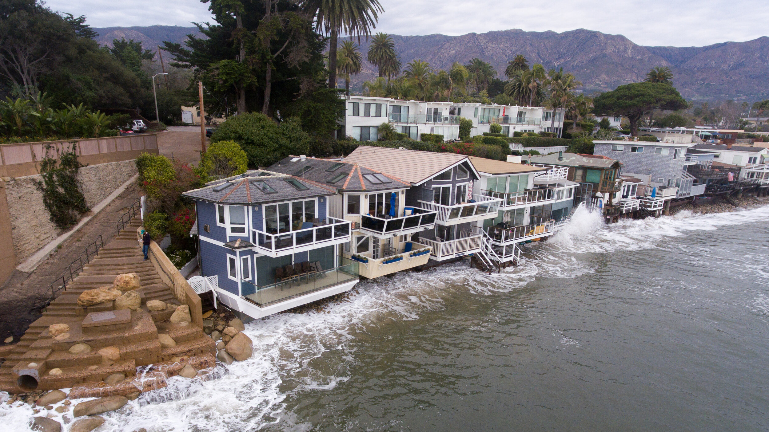
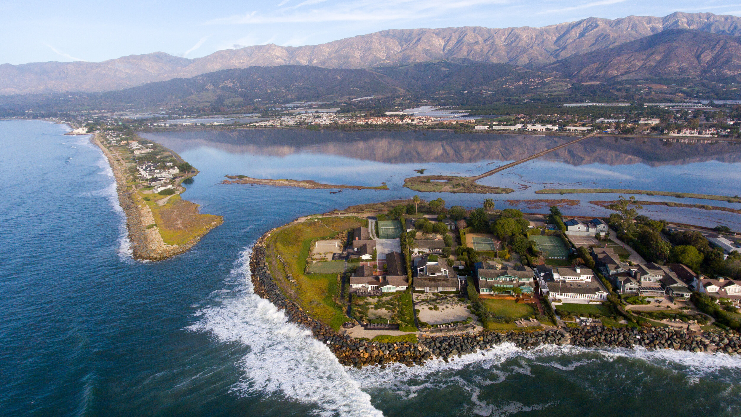
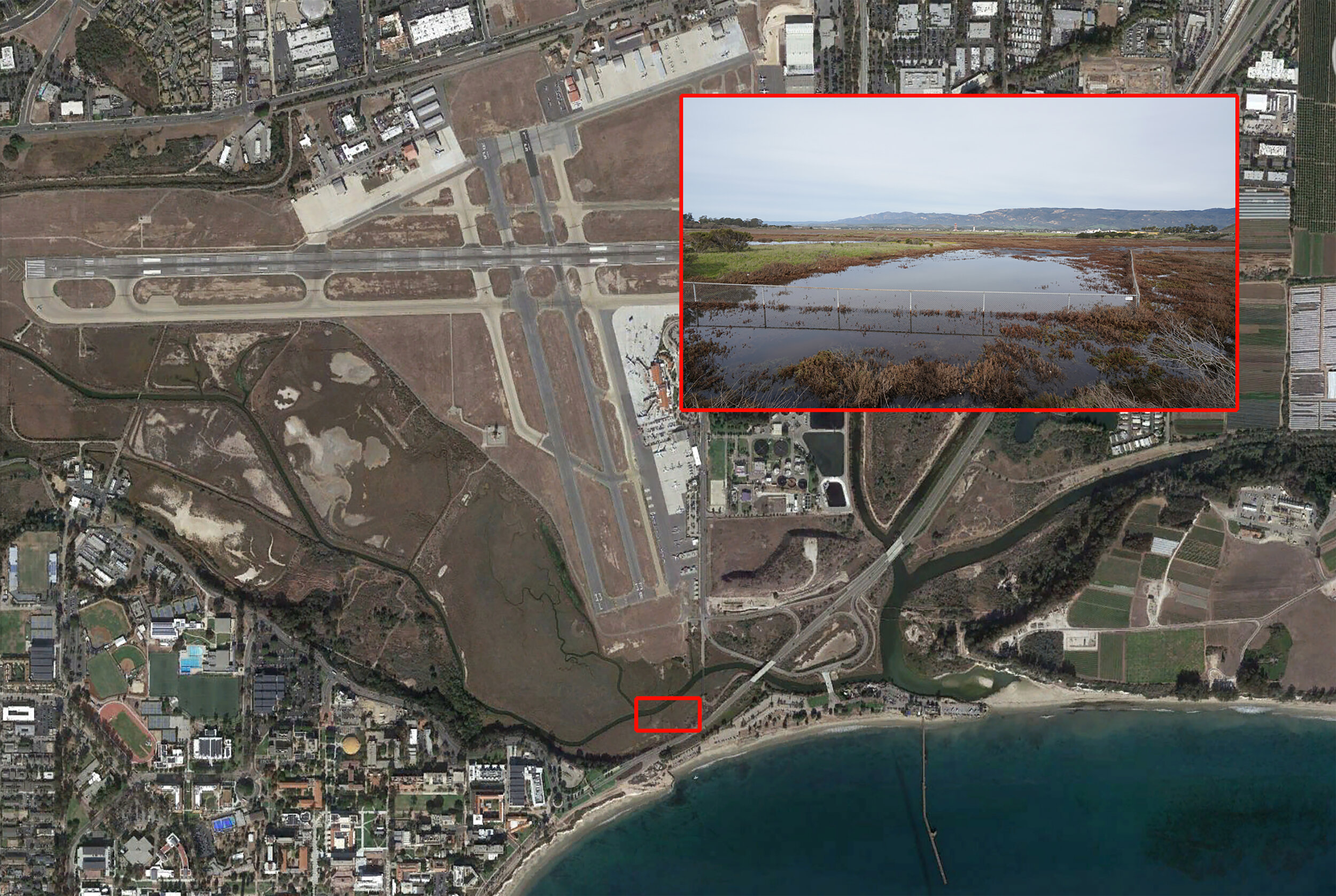
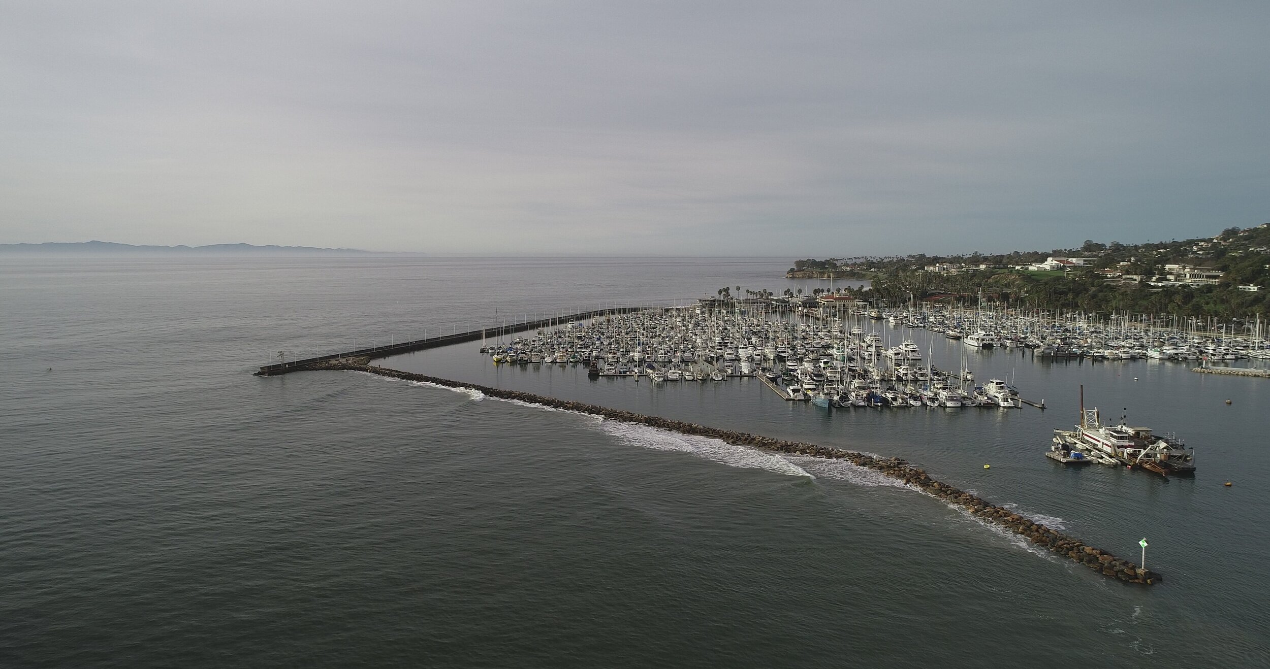
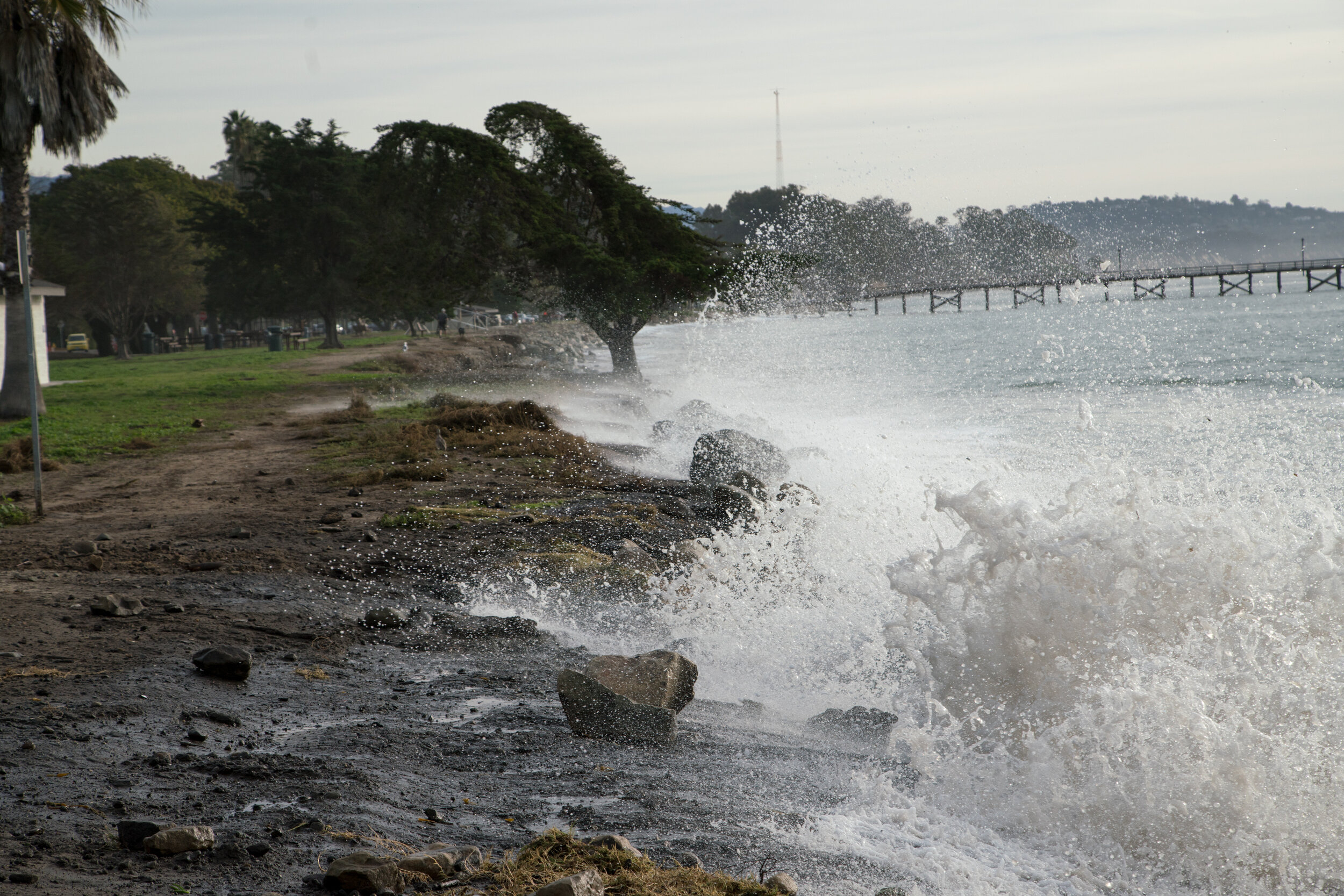
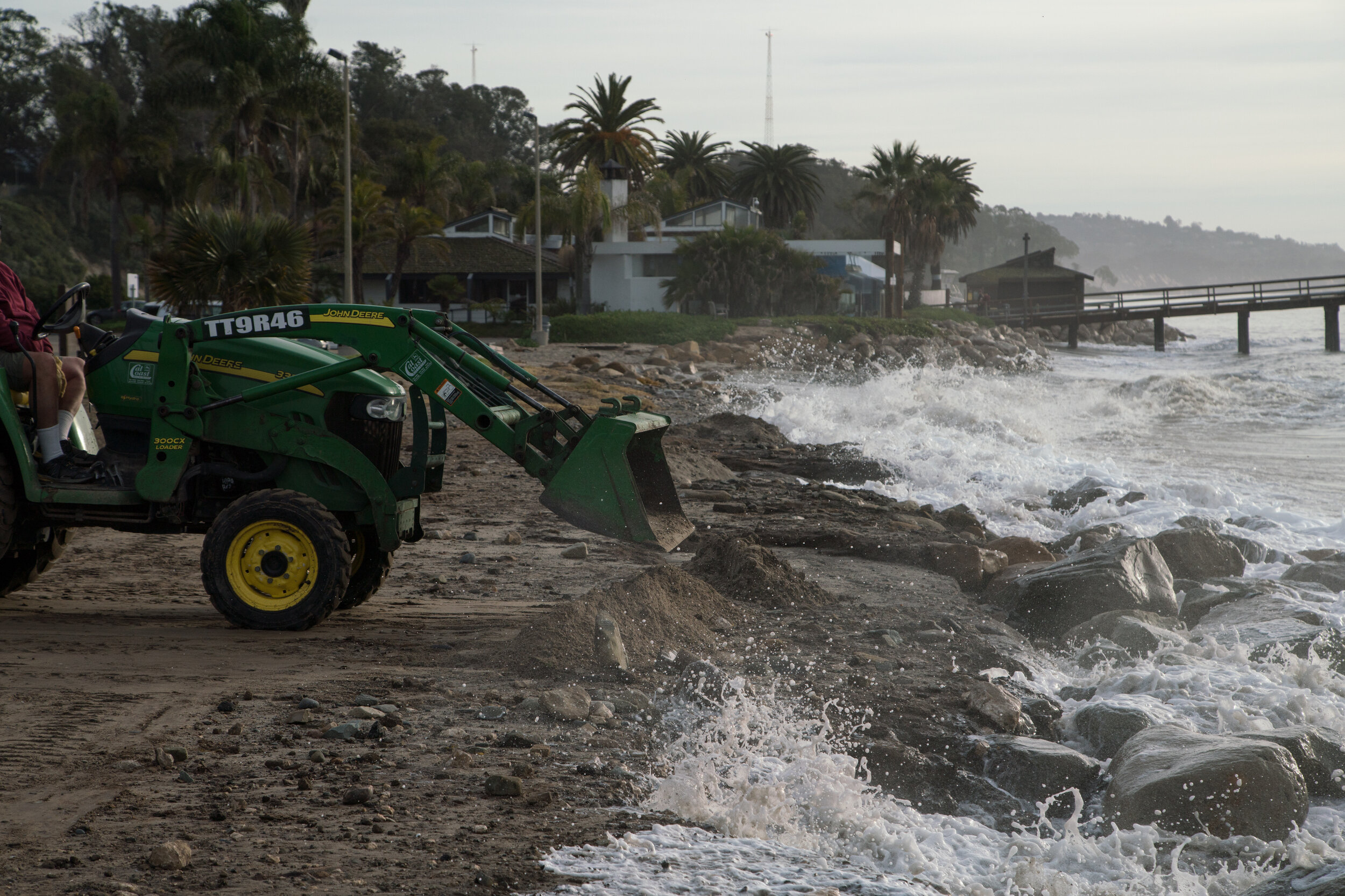
HTO contracted with photographer/pilot Harry Rabin and well-known surf photographer Branden Aroyan to photograph Sandyland/Sand Point (Carpinteria coast area), Miramar Beach, Goleta Beach, and the Santa Barbara Airport.
The photos speak for themselves. All these areas are at risk of flooding - even now, in a high tide/storm event. Years ago, as climate change symposiums and plans and analyses began to proliferate, HTO made strong input about Adaptation to Sea Level Rise. Years ago, we recognized how much of our infrastructure is in flood zones and smack in the path of an incoming ocean. We maintained then, and emphasize now, that we must act. A building permitted today should last longer than 30-50 years. All the money spent on expanding the Airport might have been better spent building a monorail to the Santa Maria airport - because the Airport is already flooding, and could be underwater in too few years.